Статистика

Онлайн всего: 1
Гостей: 1
Пользователей: 0

Faroe Islands

  • Description
  • Parameters of the autonomy
  • Illustrations
  • Comments

Autonomy’s map

It is possible to study detailed information in the profile
(in Russian):

Faroe Islands

Description of the autonomy

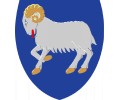
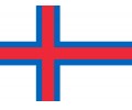
The autonomous region in the Kingdom of Denmark, Faroe Islands are located in the northern Atlantic Ocean almost in between Iceland and Scotland and represent parts of the underwater ridge protruding from the ocean. The archipelago consists of 18 islands, 17 of which are inhabited.

In 1948, when the inhabitants of Farer were going to follow the Iceland (which is close to them in ethnic, confessional, and historical respects) in pursuing independence, the Act on the Faroe Municipality was adopted, granting autonomy to the islands within Denmark. In 1973, when Denmark joined the European Economic Community, the Faroe Islands refused to enter it. Unlike Denmark itself, the main branches of the Faroe's economy are fishing, sheep breeding, and light industry.

The Faroes comprise 91% of the island population, which is much more ethnically consolidated than the rest of Denmark’s, where the proportion of immigrants from other countries (that sharply differ from Danes in ethnic terms) already exceeded 6% of the population in the early 2000s. The Faroese language differs from Danish, although they both belong to the Scandinavian subgroup, a part of the German group of the Indo-European language family. The Faroese language on the islands has an official status.

By the 1948 law, the scope of powers of the Faroe Islands’ authorities has been gradually expanded. As a result, nowadays the most of the policy issues fall under the regional government's purview, except for defence, justice, police, the national currency, and foreign policy. Nevertheless, in the autonomy there are parties that advocate the proclamation of independence.

Autonomy's characteristics

  • Year of the creation of the autonomy:
  • Geographic
  • Where is the autonomy situated:
  • Autonomy area: km²
  • Share of the autonomy in the area of the country: %
  • Autonomy population:the latest census thousands of people
  • Share of the autonomy in the population of the country: %
  • Country's characteristics
  • Level of economic development of the country:GDP per capita in 2015 in current price in $ in $
  • Political regime in the country:It is based on the Freedom House Index, 2015. All countries of the world are located on a scale from 1 (most free) to 7 (least free). Countries whose ratings fall between 1.0 and 2.5 are “Free”, between 3.0 and 5.0 are "Partly Free," and those between 5.5 and 7.0 are "Not Free."
  • Economic
  • Share of the autonomy in the economy of the country:GRP of the autonomy divided to GDP of the country (%) %
  • Level of economic development of the autonomy:relative to the country (%): GRP per capita of the autonomy divided to GDP per capita of the country %
  • Ethnic
  • Share of the dominant in the country ethnic group in the population of the autonomy:in %: population size of the dominant in the country ethnic group divided to overal population size of the autonomy (the latest census; expert estimations) %
  • Share of the titular ethnic group in the population of the autonomy:in %: population size of the titular ethnic group of the autonomy divided to overal population size of the autonomy (the latest census; expert estimations) %
  • Ethnic peculiarity:It indicates a key characteristic of autonomy's ethnic identity - language or religion or both
  • Diversity of ethnic composition:The presence of other (in addition to the titular group in the autonomy and the dominant group in the country) significant ethnic groups in the population of the autonomy
  • Political
  • Degree of self-rule of the autonomy:It is based on the Regional Authority Index project that aims at measuring the powers of all the regions in 81 countries. Here the index "tier_selfrule" (2010) is used. It summarizes five dimensions of self-rule: institutional depth; policy scope; fiscal autonomy; borrowing autonomy; and the extent to which a region has an independent legislature and executive. The index takes value from 0 to 18
  • Degree of shared-rule of the autonomy:It is based on the Regional Authority Index project that aims at measuring the powers of all the regions in 81 countries. Here the index "tier_sharedrule" (2010) is used. It summarizes five dimensions of shared-rule: participation of a region in national law-making; intergovernmental meetings; the distribution of national tax revenues; borrowing; and constitutional change. The index takes value from 0 to 12
  • The presence of the "kin-state":"Kin-state" is a state whose main population shares the ethnic characteristics of the titular ethnic group of the autonomy
  • Linguistic preferences:It indicates how the language of the titular ethnic group of the autonomy is learned in secondary schools in the autonomy
  • Ethnic conflicts:It indicates whether the serious conflicts between the autonomy and the central government as well as between ethnic groups within the authority take place in 2001-2015. The level of conflict is determined on the basis of the annual reports of Conflict Barometer

Illustration

Comments

Total comments: 0
Add comments can only registered users.
[ Registration | Login ]
Added by: LDMitay, 16.11.2017

 
The project is supported by the
Russian Science Foundation
http://rscf.ru/en
Perm State University
Russia, 614990, Perm,
Bukireva street, 15
http://www.en.psu.ru/
Perm Scientific Centre
Russia, 614990, Perm,
Lenina street, 13a
http://www.permsc.ru/
Expert network for the
identity research
http://identityworld.ru/
Идентичность © 2009 - 2024
Хостинг от uWeb